
Where Construction Survey Crews Add Value in Subdivision Buildouts
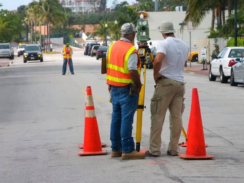
Approved plans look tidy on a screen. Turning them into roads, pads and utility lines that sit in exactly the right spot is where a construction survey earns its keep. Subdivisions raise the stakes because so much happens at once. Several crews grade, dig and pour across a shifting site, and a small position error near the start can ripple into every lot that follows. Field staking pins the paper design to real ground, so the neighborhood that gets built matches the one the plans promised. That match pays for itself many times over.
Move Approved Plans Into Accurate Field Positions
A subdivision plan carries every road centerline, lot corner and pad location, but none of that helps until crews find those points in the dirt. Survey teams translate the drawing into stakes and marks that operators can actually work to. The design leaves the page and lands where it belongs.
This handoff shapes everything downstream. Grading crews cut to the right depths, curb crews follow the right lines, and framers build on pads that sit where the plan intended. When the field positions are right from the start, the rest of the trades inherit a clean setup instead of a puzzle.
Hold Road Alignments Steady Across Multiple Work Zones
Big subdivisions rarely move in a single line. One crew works the entrance while another grades a cul-de-sac three streets away, and both have to end up connected. Survey control gives every zone the same reference, so roads meet cleanly where they’re supposed to and grades flow together instead of clashing at the seams.
Without that shared reference, small drifts creep in. A street that started a few inches off can carry that error the whole way, and fixing it after paving costs real money. Consistent control keeps separate work zones honest to one plan.
Stake Utility Runs Before Trenches Open
Water, sewer, storm and electric lines all compete for space underground, and easements set the rules for where each one belongs. Accurate staking marks those runs before a single trench opens, which keeps crews from digging in the wrong spot or crossing into ground reserved for something else. A few things get sorted before the excavator arrives:
- Where each utility enters and exits the work area
- How deep and how far a run travels between connection points
- Which easements a line must stay inside
- Where two systems cross and need clearance
Marking this early heads off the expensive scramble that follows a line placed by guess.
Keep Lot-to-Lot Layout From Drifting
One lot staked slightly off is a minor issue. That same error copied across forty lots becomes a pattern nobody wants to explain to a builder. Steady control points scattered through the subdivision let crews check their work against a fixed reference instead of measuring off the last thing they built.
That discipline protects the whole buildout. Homes land where they should, side yards stay even, and the finished streets read the way the plan drew them. Small corrections along the way beat one giant correction at the end.
Track Field Progress as the Project Grows
A subdivision under construction changes daily. Some lots get staked, others get checked, a few get adjusted after a grading change. Survey records capture what happened and when, so the project team always knows which pieces are set and which still need attention.
That running picture matters as more crews pile onto the site. Managers can see where layout is complete, where a rework happened, and what still waits. Clear field records turn a chaotic buildout into something people can actually manage.
Frequently Asked Questions
Why do subdivisions need repeated construction survey visits?
Work moves through phases, and each phase needs its own layout support. Crews stake roads early, check pads before framing and verify utilities before backfill, so the survey team returns as the job reaches each new stage rather than doing everything on day one.
Can survey crews help prevent road layout conflicts?
Yes. Accurate control keeps road alignment tied to the approved plan, so streets built by different crews still meet correctly. That shared reference catches drift before it turns into two roads that don’t line up.
How does construction surveying help utility crews?
It marks planned utility locations before anyone digs. Crews see where each line belongs, how deep it runs and which easement it sits in, which cuts down on conflicts between systems and reduces the odds of tearing something out later.
What happens if subdivision staking is done too late?
Late staking forces crews to pause or backtrack. Equipment may sit idle while layout catches up, or work already done may need correction once the stakes reveal a problem. Getting layout ahead of the crews keeps the job moving.