
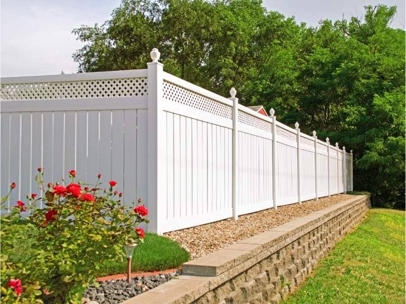
Fence Alignment Accuracy Improved Through Boundary Survey Property Mapping
Fence alignment accuracy depends on knowing exactly where the property line runs before the first post goes in. A boundary survey with property mapping gives an installer that starting point. It marks the true corners and the path between them, so the fence follows the real line instead of a guess. This guide covers why fences drift off course, how survey data guides a straight build and how good markers keep a fence true for years.
Common Causes of Fence Misalignment in Residential Property Installations
Most crooked fences start with a shortcut. An installer eyeballs the line from a neighbor’s old fence, trusts a rusty pin that may have shifted or paces off a distance instead of measuring it. Each habit feels close enough at the time. The trouble is that a small error at the first corner does not stay small. Aim the line one inch off, and a hundred feet later the fence can sit a full foot from where it belongs.
Old markers add another risk. A corner pin can get knocked loose by a mower, buried under years of soil or moved during past yard work. When a crew builds off a marker like that without checking it, the whole run inherits the mistake. Fences also drift because people adjust them by feel over time, nudging a post or shifting a panel during repairs. These small tweaks pile up until the fence no longer matches any recorded line.
Translating Boundary Survey Data Into Physical Fence Layout Positioning
A survey turns a legal boundary into something an installer can build against. The surveyor finds the true corners, ties them to measured coordinates, then marks them on the ground with stakes or hubs a crew can see and follow. Between the corners, the surveyor sets extra points along the run so the fence has a straight line to trace over long distances or around bends.
Smart layout also protects the corner itself. A surveyor often sets an offset stake a set distance inside the line, so the builder keeps a guide that will not get destroyed when the post hole gets dug. The installer measures back from that offset to place each post on the true line. With clear stakes and known distances in hand, the crew builds to the survey instead of a hunch, and the fence lands where the map says it should.
Detecting Offset Errors Between Existing Fences and Official Property Lines
An existing fence often needs checking before anyone plans a repair or replacement. A boundary survey measures exactly how far the current fence sits from the official line, point by point, so the owner learns whether the drift is a few inches or a few feet. The survey does this by comparing the fence’s mapped position against the verified corners and the coordinates that define the parcel.
The result is a clear picture instead of a rough sense of trouble. The surveyor can show that a fence starts right on the line at one corner but wanders three feet off by the far end. That tells the owner exactly where a correction has to happen. Without the measured offsets, a crew might rebuild the new fence along the same wrong path and lock the error in for another generation.
Impact of Terrain Variation on Fence Line Accuracy and Installation Stability
Flat ground makes a fence easy. Real yards rarely cooperate. Slopes, dips and uneven ground all pull at a fence line and threaten both its look and its strength. On a hillside, an installer has to either rack the panels to follow the grade or step them down in even drops, and the wrong choice leaves gaps under the panels or a jagged top.
Survey mapping helps by capturing the elevation of the land, not just its flat outline. When a survey records how the ground rises and falls along the run, the installer can plan post depths and panel styles that fit the terrain from the start. Posts set without that data often end up at uneven heights or spaced poorly on a slope, which weakens the whole fence. A fence built with the grade in mind stays straighter, holds its posts better and resists the leaning that ruins so many hillside fences within a few seasons.
Survey-Verified Layout Systems for Long-Term Fence Position Maintenance
A fence is not a one-time project, so its reference points should outlast the first build. When a surveyor documents the boundary with durable markers and recorded coordinates, the owner gains a permanent guide for every future repair, replacement or expansion. Years later, a crew can find those same points and rebuild on the exact original line instead of starting the guesswork over.
These survey-verified markers pay off most when the fence comes down. A storm takes out a section, or an owner extends the fence along a new stretch of the boundary. With the corners and offsets already documented, the new work matches the old line without measuring from scratch again. The boundary points act like a fixed template that keeps every version of the fence honest, which guards both the property line and the money spent on it.
Frequently Asked Questions
Why do fences often shift away from true property boundaries over time?
Fences move for a mix of reasons that build up slowly. Many start slightly off because the installer worked from an estimate instead of a survey. Ground movement adds to the drift, since freezing soil, erosion and settling can push posts out of line season after season. Owners also make small informal changes during repairs, and those unrecorded adjustments gradually pull the fence away from where it began.
Can a boundary survey correct an already installed misaligned fence?
A survey identifies the problem, but it does not do the physical work. The surveyor measures how far the fence sits from the true line and marks where the correct boundary runs. Moving the fence itself falls to the owner and a fencing contractor, who use the survey data as their guide. Think of the survey as the accurate map that shows exactly what needs to change and by how much.
How accurate are boundary survey markings for fence installation projects?
Professional survey markings are far more precise than any visual estimate, often accurate to a fraction of an inch at each staked point. Licensed surveyors work to set standards and tie every mark to verified corners and coordinates. That precision gives a fencing crew reliable targets to build against, which removes almost all the guesswork behind alignment problems.
What happens if neighbors disagree on fence placement after a survey?
A completed survey usually settles the disagreement because it rests on verified legal boundaries, not opinion. The surveyor’s marks and report show where the recorded line actually falls, giving both neighbors the same set of facts to work from. If one party still objects, the documented survey becomes strong evidence for a formal boundary agreement or, in rare cases, a legal review that relies on that same data.