
Why Boundary Surveying Matters Before You Buy or Build
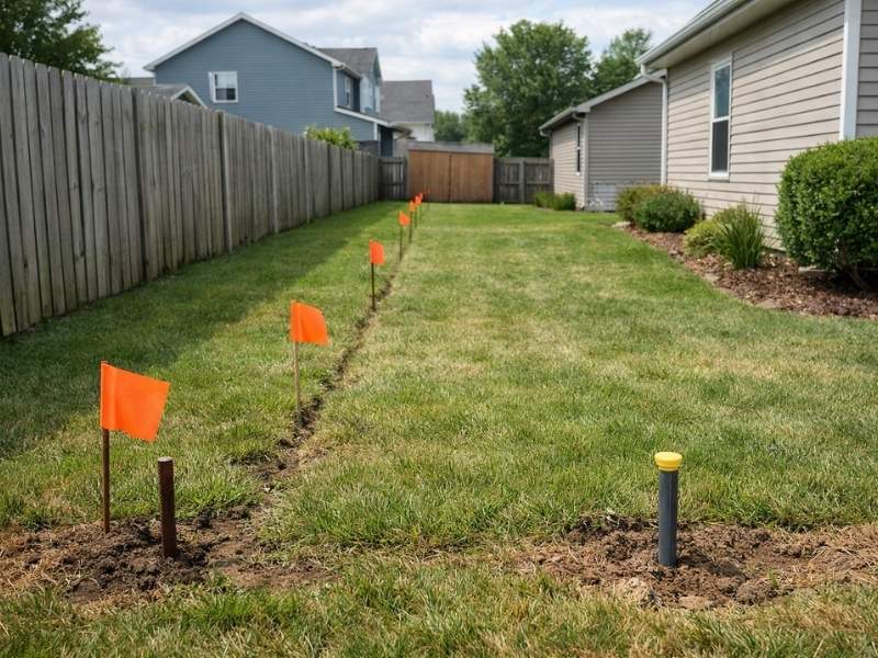
People lose money on property every year because they skipped boundary surveying. They buy a lot that’s smaller than the listing said. They build a structure that crosses a line they didn’t know about. They close on a property and inherit someone else’s encroachment problem. All of it was preventable. This article explains what boundary surveying is, what it finds and why doing it before you buy or build is the smarter move.
More Than Just Lines on a Map
Boundary surveying establishes the legal edges of a property. A licensed land surveyor reviews recorded deeds, plats and adjoining property records. Then a field crew goes to the site and finds or sets the physical corner markers that match those records.
The result is a confirmed set of boundary lines you can rely on. Not an estimate. Not a guess from the tax map. A legally defensible measurement tied to recorded documents.
That matters because the lines you see on county maps and online parcel viewers are approximations. They’re useful for general reference and terrible for making construction or purchase decisions.
What a Surveyor Finds That Nobody Else Does
A boundary survey often turns up things a buyer or developer had no idea about.
Lot size discrepancies are common. The recorded acreage in a deed doesn’t always match what’s actually there when a surveyor measures it. This happens more often on older properties where historical surveys were less precise.
Encroachments show up regularly. A neighbor’s fence, shed or driveway sitting on your land is an encroachment. So is your structure sitting on theirs. Encroachments don’t go away on their own. They have to be resolved, and resolving them after closing or after construction is expensive.
Overlapping deed descriptions are another issue. When adjoining deeds describe boundaries that don’t match, you get a gap or an overlap between properties. That creates a title problem. Title companies flag it. Lenders flag it. Buyers get stuck dealing with it if it wasn’t caught beforehand.
Recorded easements also show up. Utility easements, drainage easements and access easements are tied to the land regardless of who owns it. A developer who doesn’t know about a recorded easement running through a planned build area will find out the hard way.
Why the Title Search Isn’t Enough
A lot of buyers assume the title search will catch everything. It won’t. A title search reviews recorded documents. It doesn’t send someone to the property with measuring equipment.
An encroachment from a neighbor’s fence won’t show up in a title search if it was never recorded. A lot that’s been informally occupied beyond its legal boundary for decades won’t appear in a deed. Those things require a physical survey to find.
By the time a buyer is at closing, they’ve paid for inspections, appraisals and due diligence. Walking away gets expensive. Catching a boundary problem before you make an offer gives you real leverage. You can renegotiate the price, require the seller to resolve the issue or walk away without losing anything.
The Risk Developers Take Without One
For developers, boundary surveying isn’t optional. It’s the foundation of every decision that follows.
Site design starts with an accurate boundary. If the boundary is wrong, the site plan is wrong. If the site plan is wrong, the permit application is based on bad data. That leads to rejection, redesign and delay.
Setback calculations require confirmed boundary lines. You can’t know if a planned structure meets zoning setback requirements without knowing exactly where the property line is. A line that’s off by two feet changes the math on a tight lot.
Multi-parcel projects need each boundary confirmed before any work starts. One bad boundary in a group of assembled parcels can affect the entire development footprint.
Recorded surveys also provide legal protection if a dispute comes up later. A developer with a licensed survey on file has documented evidence of where the line was at the time of construction. That matters in court and in front of zoning boards.
The Right Time to Order One
Order it before you make a binding commitment on a property. That means before you sign a purchase contract or, at minimum, during the due diligence period while you still have the option to exit.
For development projects, order it before the design process starts. Your civil engineer and architect need accurate boundary data to produce a usable site plan.
For construction projects, order it before you pull any permits. Local building departments check setbacks against property lines. If your boundary data is wrong, the permit review will expose it at the worst possible time.
If you already own the property and haven’t had a survey done, order one before you start any new construction, add any permanent structures or get into a dispute with a neighbor over the line.
Important Boundary Surveying Facts Property Owners Should Know
Boundary surveying is regulated at the state level, and only a licensed Professional Land Surveyor can certify boundary work. Many lenders and title companies require a current survey before closing, especially on commercial properties. Boundary surveys also help identify easements, encroachments and other issues that can affect a property’s value or future development. Finding these problems early is much easier and less expensive than dealing with them after construction or closing.
Frequently Asked Questions
What is boundary surveying and why does it matter?
Boundary surveying establishes the legal edges of a property through field measurements tied to recorded documents. It confirms the actual size and shape of a parcel, identifies encroachments and easements and gives buyers and developers accurate data before they commit to a purchase or a build.
How is a boundary survey different from what a title company does?
A title company reviews recorded documents to check ownership history and flag recorded issues. A boundary survey sends a licensed surveyor to the field to physically measure and confirm the property lines. The two processes serve different purposes and neither replaces the other.
Can I rely on the county parcel map instead of ordering a survey?
No. County parcel maps are approximations used for tax and administrative purposes. They are not survey-grade measurements and should not be used to make construction or purchase decisions. Only a licensed land surveyor’s certified work carries legal weight.
What problems does a boundary survey commonly find?
Common findings include lot size discrepancies, encroachments from neighboring structures, overlapping deed descriptions, gaps between adjoining parcels and recorded easements the buyer or developer was unaware of. Any of these can affect a project’s feasibility or a property’s value.
When should I order a boundary survey for a development project?
Order it before the design process starts. Your civil engineer needs accurate boundary data to produce a site plan. Ordering it after design work begins risks having to redo plans if the boundary turns out to be different from what was assumed.